Difference between revisions of "Yeoman"
(→Manual) |
|||
| (3 intermediate revisions by the same user not shown) | |||
| Line 1: | Line 1: | ||
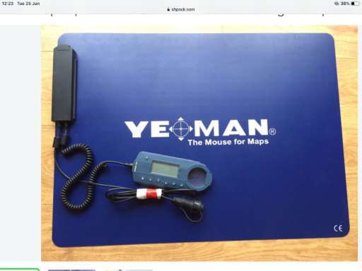
| − | Sadly no longer available but a brilliant concept. The mat digitises a paper chart and, when connected to your GPS, shows your current postion, | + | Sadly no longer available but a brilliant concept. The mat digitises a paper chart and, when connected to your GPS, shows your current postion, bearing and distance to other points on the chart. |
[[File:yeoman.jpg]] | [[File:yeoman.jpg]] | ||
| + | |||
| + | |||
| + | == Manual == | ||
| + | |||
| + | [[File:yeoman.pdf]] | ||
Latest revision as of 09:18, 27 June 2019
Sadly no longer available but a brilliant concept. The mat digitises a paper chart and, when connected to your GPS, shows your current postion, bearing and distance to other points on the chart.
